Taipei: From a Water City to a Land City
Taipei's old waterway system underwent significant changes after World War II due to urban development. The focus of water management shifted rapidly away from traditional water-related activities, leading to the rapid shrinking, disappearance, or consolidation of many ponds, which transformed into elongated drainage channels to reclaim more land for human use.
By comparing the current urban fabric, most of the old waterways have evolved into today's road systems, drainage systems (stormwater sewers), parks, linear green spaces, or other public facilities such as schools and flood control areas. Only a few waterways in suburban areas, like Guandu and Zhoumei, have preserved some agricultural characteristics. However, on a basin-wide scale, the small irrigation branches within the old waterway system have been largely buried or covered over the course of nearly three centuries of changes in the internal water environment.
The Transformation of Inland Water and Public Demand
In the past, the main focus for rivers in Taipei City was flood control and ensuring residential safety, often achieved through embankments and flood prevention measures. However, in recent years, there has been an increasing demand from the public for a more ecologically-friendly, recreational, and scenic environment around water resources. Additionally, the challenges posed by extreme weather events in urban areas have prompted a reevaluation of the relationship between people and water.
With these considerations, policies have been reexamined to bring people closer to water and to reshape the relationship between people, water, and daily life. The goal is to create a livable city where humans and nature can harmoniously coexist, taking into account ecological, recreational, and aesthetic aspects of the water environment.
Systematic identification of priority construction sites
After undergoing urban development and landscape changes, previous water canals and ponds have been transformed into underground drainage systems beneath urban roads and streets. Some have been filled, covered, and repurposed for other uses, while others have been intercepted, leaving only remnants of visible depressed terrains that have become part of open spaces between parks or buildings. Therefore, the construction of internal water features requires a systematic approach to assess the possibilities.
Identification of Spatial Development for Internal Water Environment Creation
Point: Restoration of Ponds in Mountainous Areas.
In mountainous regions, rainwater flows from steep slopes to flat urban areas, resulting in a transition from fast to slow flow and potential water accumulation due to poor drainage. In the past, this led to the presence of numerous ponds, but with urbanization, many of them have been reclaimed or covered for other purposes. It is recommended to gradually restore these pond landscapes to alleviate runoff and enhance ecological functions.
Line: Environmental Creation of Waterway Corridors in Urban Areas
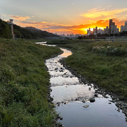
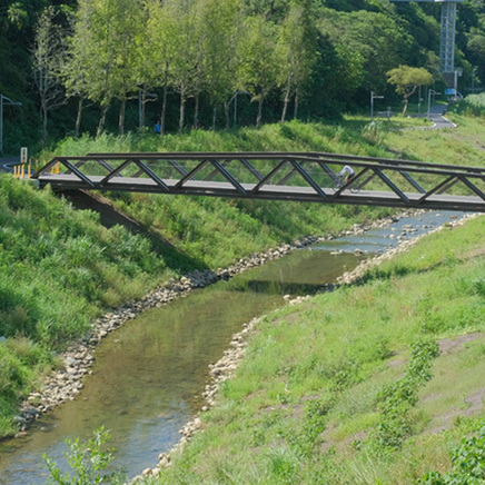
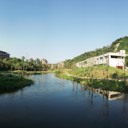
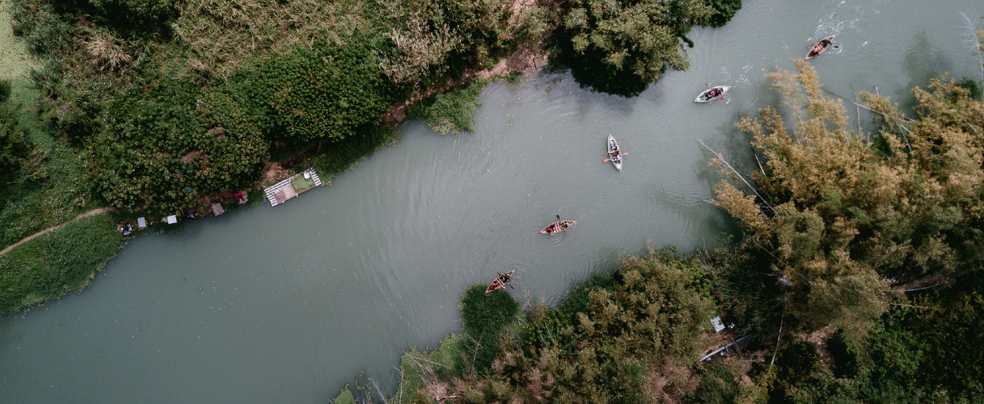
Rivers and water bodies are vital resources for constructing urban ecological lifestyles. In the past, Taipei City's rivers were primarily managed through embankments to ensure residential safety and flood control. However, in recent years, there has been an increasing demand from the public for ecological, recreational, and scenic surroundings related to water. Additionally, extreme weather events pose challenges to urban areas. As a result, policies are being reconsidered to reshape the relationship between people and water, aiming to create harmonious and livable cities where humans and nature coexist.
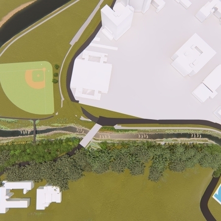
Area: Watershed - Integration of Blue-Green Infrastructure (Exemplified by Xinyi District)
From the perspective of overall urban drainage, it is recommended to integrate blue-green infrastructure in various watershed areas to enhance the city's resilience to flooding and mitigate the impacts of heavy rainfall. In addition to the point-based restoration of ponds and the creation of linear waterway corridors, efforts should also be made to identify public lands that can serve as retention basins. For example, parks and green spaces can assist in diverting runoff, and road infrastructure can be modified to accommodate flood control measures. These actions will contribute to improving the overall resilience to rainwater and flooding in the region.
Point Selection Process for Environmental Creation
Step 1: Internal Water Environment Zoning
The internal water zoning in Taipei is primarily based on the natural environmental conditions of the basin, which is surrounded by natural mountain ranges. The Keelung River divides the basin into two blocks: north and south. Each block is further divided into subzones based on the respective mountain ranges. The remaining areas are categorized as "Built-up Basin Zone," which encompasses the surrounding river drainage. These five environmental zones align with Taipei City's major drainage system subdivisions.
Step 2: Waterway Heritage Line Analysis
By overlaying the drainage system, waterway heritage lines, parks, and road systems, the intersection points are identified. After an initial screening based on land characteristics such as ownership (prioritizing public land), land use zoning (including undeveloped lands), and connectivity to nearby public spaces (e.g., schools), a total of 52 potential locations for point, line, and area interventions are identified.
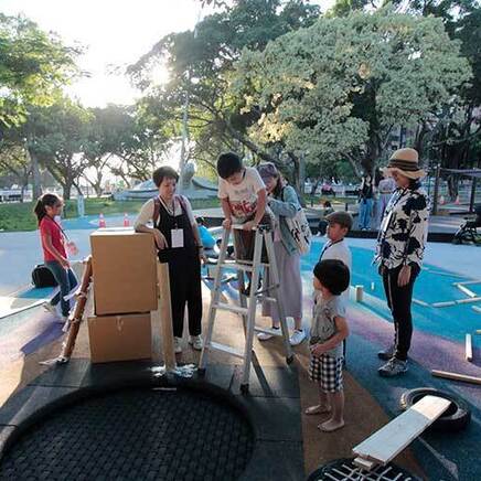
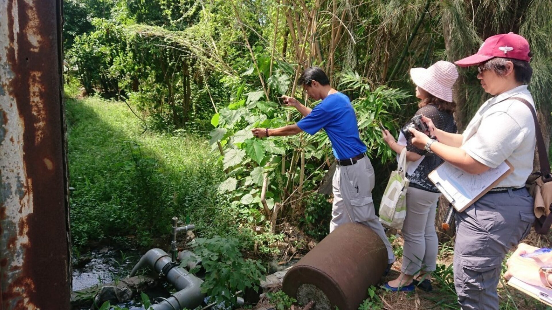
Step 3: Public Participation - Expert Symposium and Workshops
Taking into account the opinions of experts, community colleges, and social groups, the feasibility of each potential candidate location is assessed based on criteria such as activity promotion, community engagement, accessibility, noticeable improvements, water source stability, water quality pollution levels, land acquisition costs, and inter-departmental collaboration requirements. This analysis serves as a reference for the government in selecting the intervention locations. A series of workshops is conducted to further advance the project.
Step 4: Three Major Vision Demonstration Sites
Based on the analysis of the 52 potential locations and input from interviews with experts, community colleges, and social groups, three demonstration sites and nine potential candidate locations are selected, totaling 12 potential sites. Additionally, preliminary improvement strategies are proposed based on the conditions of the potential candidate locations, serving as a foundation for future discussions on the environmental creation vision.
Based on the selection process, three demonstration sites have been chosen: Dongda Pailou, Minzu Junior High School, and Wufen Harbor Creek. Further analysis, planning, and design will be conducted for these three sites. In this article, we will focus on the example of Dongda Pailou.
Overall Concept for Dongda Pailou
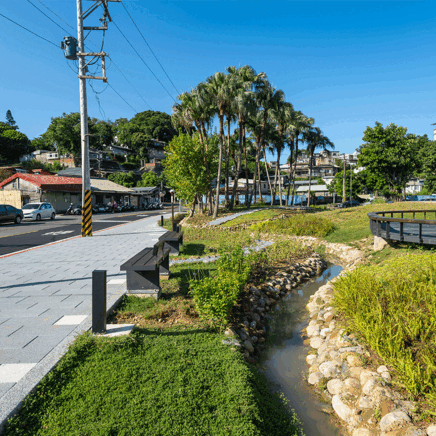
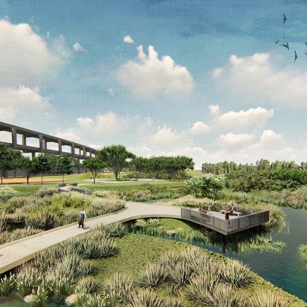
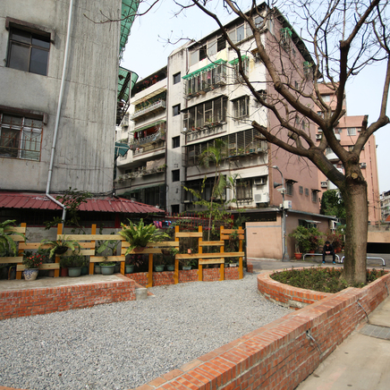
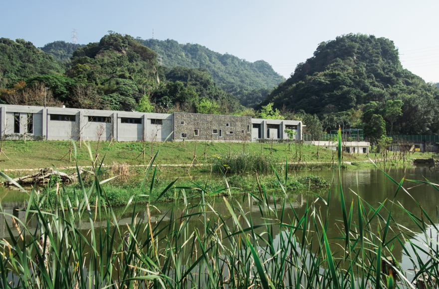
Dongda Pailou is one of the few existing waterways that still maintain an open channel. It has stone revetments upstream and concrete walls on three sides downstream. Along the channel, there are still military camps and a few households discharging wastewater. Based on the consensus of participants in the public workshops, most people expressed a desire to improve the relationship between Dongda Pailou and the surrounding green spaces. By utilizing the water resources of Dongda Pailou, it is envisioned to create a water-green space where people can easily connect with the urban water environment. In addition to existing open spaces, it is also hoped that future urban renewal efforts can preserve the waterway and incorporate water features into public spaces within the neighborhood.
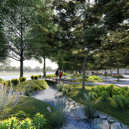
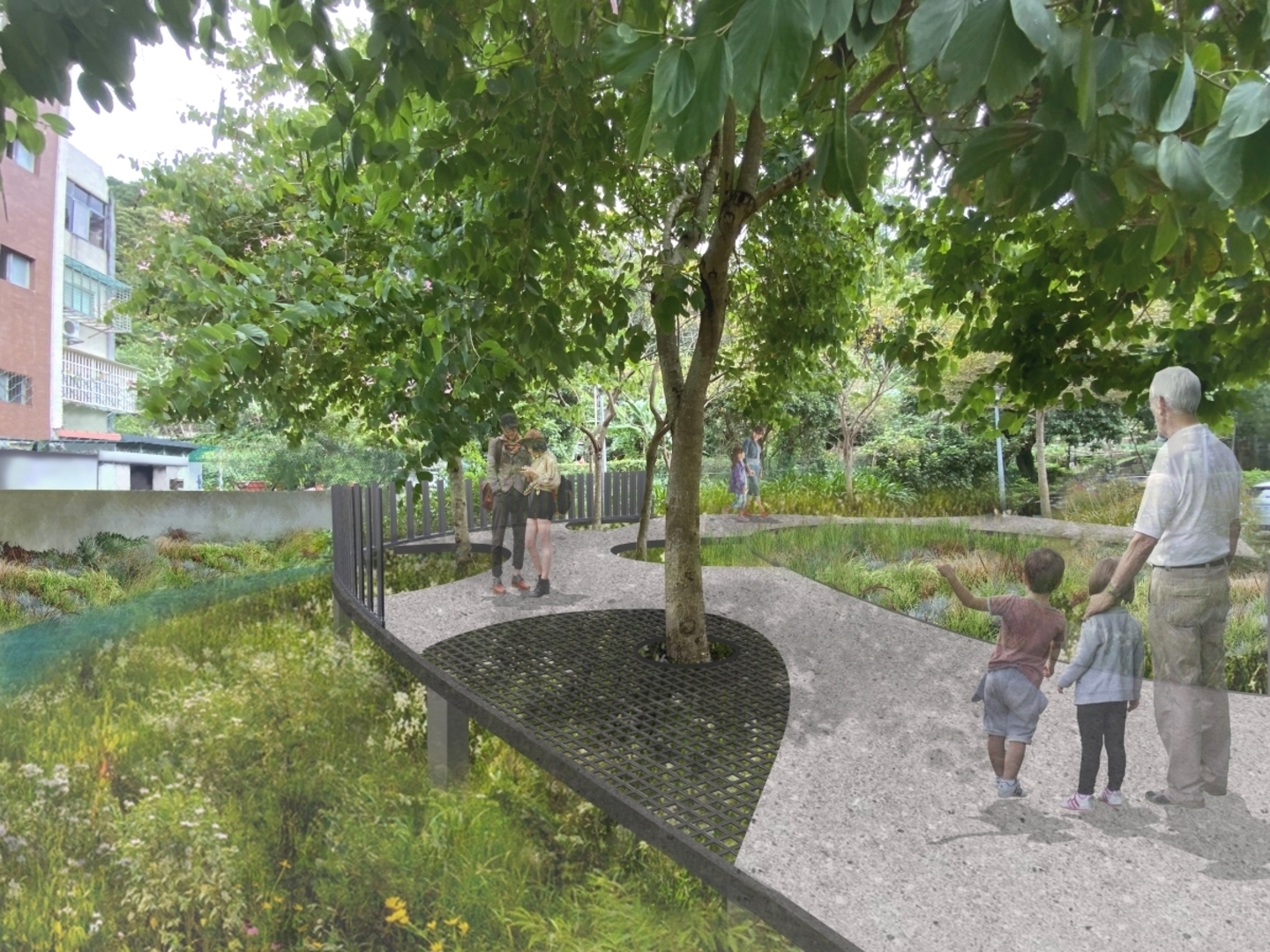
Demonstration Site: Guangxing Wucun Water-Green Space in Dongda Pailou
Based on the consensus of workshop participants, the goal is to enhance the relationship between Dongda Pailou and the green spaces of Guangxing Wucun. By utilizing the water resources of Dongda Pailou, a water-green space will be created to allow people to easily connect with the urban water environment. The following design concepts have been proposed: shallow water areas (including rainwater gardens), grassy slopes, plazas, and terraced platforms, as well as the renovation of revetments while preserving existing large trees and maintaining parking space functionality. The subsequent design will focus on bringing the water canal closer to the green space, creating an ecologically friendly and user-friendly green space in the urban area. By creating a water environment, it aims to provide habitat for wildlife and establish pathways for their movement. The integration of blue and green spaces through spatial creation will enable people to naturally and easily engage with water, enhancing biodiversity and raising awareness of the water environment.

Classic Landscape Design and Environmental Planning. Ltd
2022 10th TILA Landscape Awards-Outstanding Award
環境規劃設計類
Other Works